Glasgow Maps and Orientation
(Glasgow, Scotland, UK)
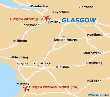
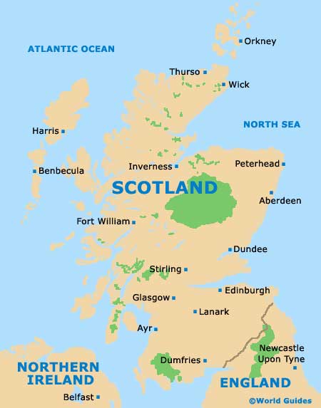
The biggest of Scotland's cities, Glasgow may not be the capital, but it certainly makes up for this in size and popularity. Glasgow stands on the westerly side of the Scottish Central Belt, on the northern banks of the River Clyde.
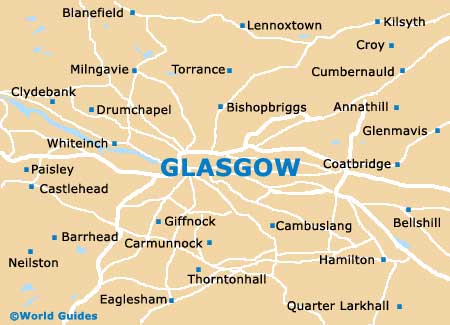
Locals generally think of Glasgow as being split into two main zones - the City Centre and the West End. Within the City Centre are the main shops and cultural attractions, while the West End has become known for its concentrations of bars and eateries, which tend to be within close proximity of the University of Glasgow and Kelvingrove Museum. Anderston, Blythswood Hill and Merchant City are all considered to be neighbourhoods of the centre, with Merchant City being an important entertainment and commercial sub-district.
Maps and Orientation of the City
George Square is Glasgow's principal square and is a good place to meet up, being just a short stroll away from many popular sights and educational institutions, such as the City College and the university of Strathclyde, as well as the City Chambers. A useful tourist office is close by and is a good source of city maps. To the south, St. Enoch Square is home to a travel centre and an SPT (Strathclyde Partnership for Transport) Subway Station.
- Airdrie - 14 miles / 23 km (25 minutes, east)
- Bellshill - 12 miles / 19 km (20 minutes, east)
- Blairskaith - 7 miles / 11 km (15 minutes, north)
- Bridgend - 10 miles / 16 km (18 minutes, north-east)
- Clydebank - 7 miles / 11 km (15 minutes, north-west)
- Coatbridge - 11 miles / 18 km (20 minutes, east)
- Dumbarton - 19 miles / 31 km (35 minutes, north-west)
- Edinburgh - 51 miles / 82 km (one hour and ten minutes, east)
- Erskine - 13 miles / 21 km (25 minutes, west)
- Hamilton - 16 miles / 26 km (30 minutes, south-east)
- Larkhall - 19 miles / 31 km (35 minutes, south-east)
- Motherwell - 16 miles / 26 km (30 minutes, south-east)
- Paisley - 9 miles / 14 km (18 minutes, west)
- Renfrew - 7 miles / 11 km (15 minutes, west)
- Strathaven - 22 miles / 35 km (40 minutes, south)
- Strathclyde Business Park - 12 miles / 19 km (20 minutes, east)
- Wishaw - 20 miles / 32 km (40 minutes, south-east)
Map of the United Kingdom

Map of Scotland
Map of Glasgow